Lesson Plans
14 The Special Collections World Tour: Incorporating Historical Maps in Class Instruction
Incorporating Historical Maps in Class Instruction
Evan Spencer
At Special Collections at the University of Texas at Arlington (SPCO), we strive to use our materials in class instruction sessions. As the Public Services Archivist, I have adopted a “yes” mentality when approached by faculty looking to enhance their courses, especially when those faculty want to use our materials to create engagement that goes beyond the traditional “show and tell” approach.
Most classes engaging with SPCO are upper level, which are typically capped at around twenty-five students and have an average of 15 attendees. In the past large entry level classes have been out of our reach, in part due to logistical concerns, but also because of a sense that hosting large numbers of students was somehow unsafe or detrimental to the materials.
When Dr. Leah McCurdy approached me about creating an in-person instruction session for her introductory Art History course of seventy-five students, I was initially concerned about the logistics of pulling it off. The “yes” mentality has limits, and with this class there were a lot of potential issues that could have led us to say no. Those challenges included the number of students (about triple the size of large classes in our “comfort zone”), the size and shape of our reference space, and the short class meeting time (fifty minutes).
With these challenges in mind, I weighed the benefits of this partnership. First, Art History has a strong emphasis on researching with primary sources. Despite this, SPCO had yet to make a connection with students in UT Arlington’s Art & Art History Department. Hosting an entry-level class with a high volume of freshmen and sophomores in Art History would serve as an introduction that would increase awareness and ideally further usage throughout their studies. Second, I wanted to test the self-imposed boundaries placed on prior class instruction. I did not want to assume that our space could not accommodate seventy-five people, I wanted to put it to the test! If it did not work, at least I would have evidence and a learning experience. Finally, there is something to be said about having an enthusiastic faculty partner. When a faculty member is excited about working SPCO materials into their course—willing to alter the “tried and true” syllabus for an entry-level course that has been taught dozens of times before—I am able to form a true partnership with them that allows for creative, engaging instruction opportunities. With these benefits on the table, we decided to figure out a way to make it work!
ART1317 – Introduction to World Art History
This course focuses on art and art history from Asia, Africa, Oceania, and the Americas, and is usually taken by freshmen and sophomores who have varying levels of knowledge about the world and these regions. When studying art from each region, it is imperative that students have a basic understanding of geography and history to provide context for their readings, class discussions, and assignments.
To ensure that students entering the course are prepared to study geographic regions of the world, Dr. McCurdy and I devised an activity using historical maps from SPCO’s Virginia Garrett Cartographic History Library. At the beginning of each semester, her class comes to SPCO to participate in what we have now dubbed the “SPCO World Tour” activity.
The primary learning objective for this activity is to give students a baseline of geographic knowledge. Additional learning objectives for the session include visiting UTA’s Central Library and developing awareness of SPCO and its resources, observing historical materials and explaining specific observations, and relating historical materials to class discussions and works of art. This visit also helps set the stage for return trips to SPCO later in the semester for other activities centered around document analysis and critical thinking. Although we created the following activity specifically for an Art History class at UTA, I believe that it can be iterated upon in any number of situations, with different maps or other primary sources.
The SPCO World Tour
For a class of seventy-five people to gain awareness of seven distinct geographic regions in fifty minutes, there has to be a firmly set plan in place. As mentioned earlier, this plan can be shifted or molded to whatever setting, time allotment, and number of students necessary. I will outline the logistics that have helped make our visits successful—but feel free to adapt!
Initial Planning
Prior to the first session, I worked with SPCO’s Cartographic Archivist, Ben Huseman, to identify three historical maps of each of the seven world regions. I also located an open-source modern map of each region (or as close as possible) via the CIA World Factbook[1] and printed those maps for use in the class (note: in the fall 2023 session, we removed the modern maps and the results seemed about the same!).
Dr. McCurdy created a worksheet (Figure 1) that encourages engagement and critical thinking as the students move through the World Tour. Although Dr. McCurdy created this worksheet herself, it mirrors themes from other SPCO class sessions. It is great to have enthusiastic faculty partners who invest in the process, but when forming relationships, you may need to provide examples or even take charge of this element.
Figure 1: Station #1
Describe an interesting observation you make from one of the HISTORIC maps by specifying what it looks like, where it is on the map, and you think it is (in written or annotated sketch form). Identify the map.
Of the 18 artworks we have discussed in class thus far, circle all those that derive from this major region.
Click here to download Figure 1 worksheet.
“Day Of” Logistics
To set up, each of the seven regions gets its own table with maps (with no other identifying information other than what is on the map) and a station number. We break the students into seven groups and invite other SPCO and Library staff members to participate as group leaders. Each starting station also has clipboards, worksheets, and pencils. Dr. McCurdy assigns the students group numbers based on their last names.
For the activity, we allow five minutes for students to come into Special Collections and get to their starting stations, followed by five minutes at each station to view maps and answer the questions on their worksheets. The timeline is available below as Figure 2. As the leader of the session, I keep time on my phone and instruct group leaders when to move. In the fifty minutes of class, this timeline allows students to view maps from all seven geographic regions, with ten minutes leftover at the end to return to any station they need more time to complete.
Figure 2: Timeline
ART1317 SPCO World Tour 1/20/2023
ROUGH TIMELINE
11:00-11:05 — Evan and Kathryn will greet students as they enter and direct them. After setting down bags, food, and drinks, students proceed to their starting station. Other staff should be at their stations ready to rumble.
11:05-11:10: first station view time
11:10-11:15: second station view time
11:15-11:20: third station view time
11:20-11:25: fourth station view time
11:25-11:30: fifth station view time
11:30-11:35: six station view time
11:35-11:40 seventh station view time
11:40-11:50 Time to go back to complete worksheets (group leaders stay at your final table)
Learning Objectives in Action
We designed this session specifically to encourage engagement with the materials. Rather than simply viewing maps from each region, students complete their worksheets and actively discuss the questions with their groupmates.
At each station, the group views and discusses the maps. Group leaders can provide basic bibliographic information (creator, year, language), and encourage critical engagement by asking basic questions that will require a closer look at the maps to answer. Each student in the group must identify the region, describe or sketch something they find interesting about one of the historical maps, and identify one artwork from their textbook that originates from that region. [2]
The questions are designed to get students to engage with maps up to six centuries old, relate historical materials to what they are learning in class, and create a foundation of knowledge that they can build upon later in the course.
The Maps
In our version of this World Tour activity, we use twenty-one different maps from our collections. Please feel free to use these maps in any way you see fit under Creative Commons CC BY-NC 4.0 licensing (although most are in the public domain)—or as inspiration for a similar activity with your own collections!
Station One: Central and West Asia
- Map One: Turcici Imperii Imago by Hendrik Hondius.[3]
- Map Two: Perigrinatie ofte Veertich-Jarige Reyse der Kinderen Israels by Jacob and Pieter Keur.[4]
- Map Three: Johnson’s Turkey in Asia, Persia, Arabia, &c by Alvin J. Johnson and Benjamin P. Ward.[5]
Station Two: Oceania
- Map One: Marshall Islands Stick Chart.[6]
- Map Two: Descriptio Maris Pacifici by Abrahamus Ortelius.[7]
- Map Three: Australia by John Arrowsmith.[8]
Station Three: Africa
- Map One: Tavola, & discrizzione universale di tutta l’Africa by Sebastian Münster. [9]
- Map Two: A New, Plaine & Exact Mapp of Africa by Robert Walton and Nicholas J. Visscher.[10]
- Map Three: Afrika by Martin Kunz.[11]
Station Four: South and Southeast Asia
- Map One: Burmah, Siam, and Cochin China by John Arrowsmith.[12]
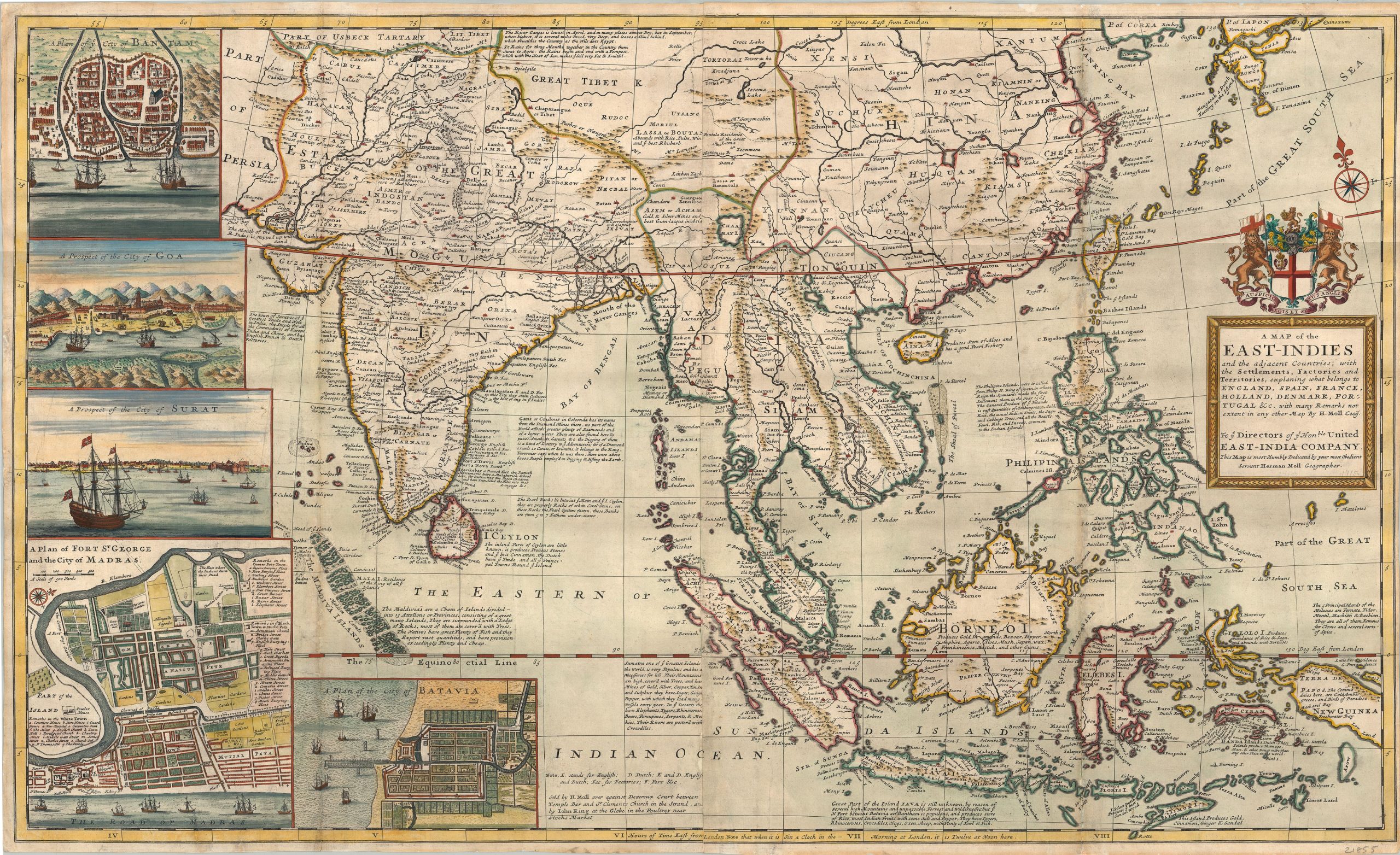
- Map Two: A Map of the East Indies and the adjacent countries by Herman Moll.[13]
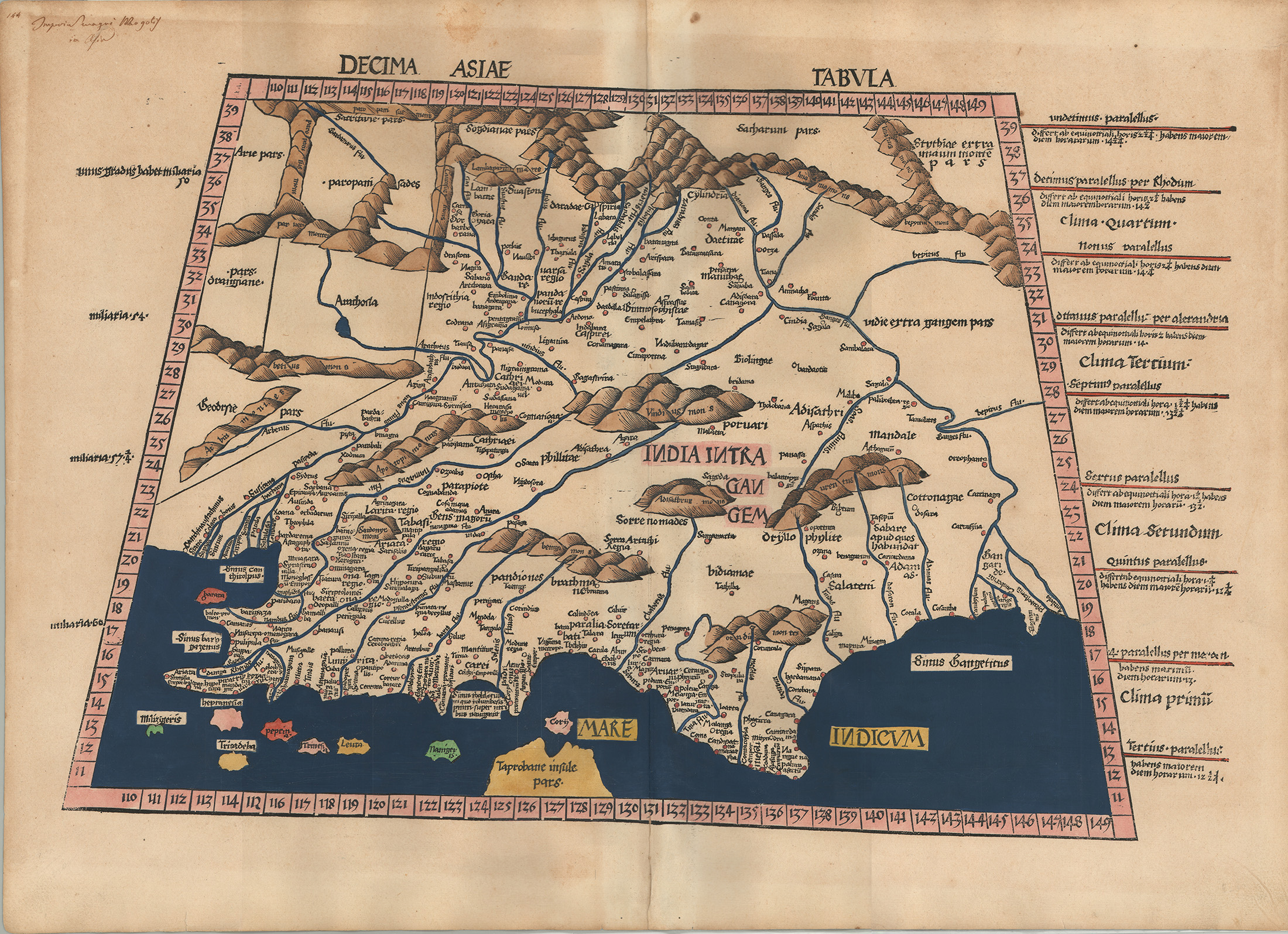
- Map Three: Decima Asiae Tabula by Martin Waldseemüller and Claudius Ptolemy.[14]
- Map Four: A New & Accurate Map of the Southern Province of Hindoostan by Augustus S. Mitchell.[15]
Station Five: The Americas
- Map One: America Settentrionale by Vincenzo Coronelli.[16]
- Map Two: A Map of the West Indies or the islands of America in the North Sea with ye adjacent countries by Herman Moll.[17]
- Map Three: A Map of South America by Jean Baptiste Bourguignon d’Anville.[18]
Station Six: Europe
- Map One: [Europe Depicted as a Queen] by Sebastian Münster.[19]
- Map Two: Carte Generale des Postes de L’Europe by John Rocque.[20]
- Map Three: Russia & Poland by John Arrowsmith.[21]
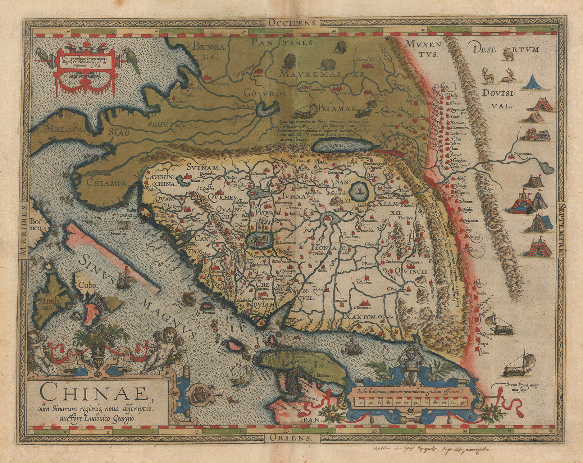
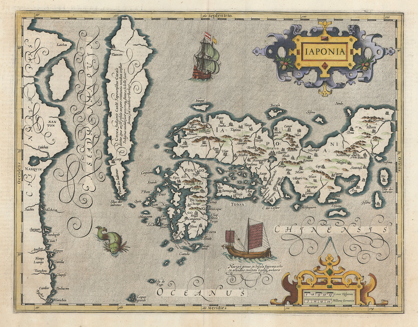
Station Seven: East Asia
- Map One: Chinae by Abrahamus Ortelius.[22]
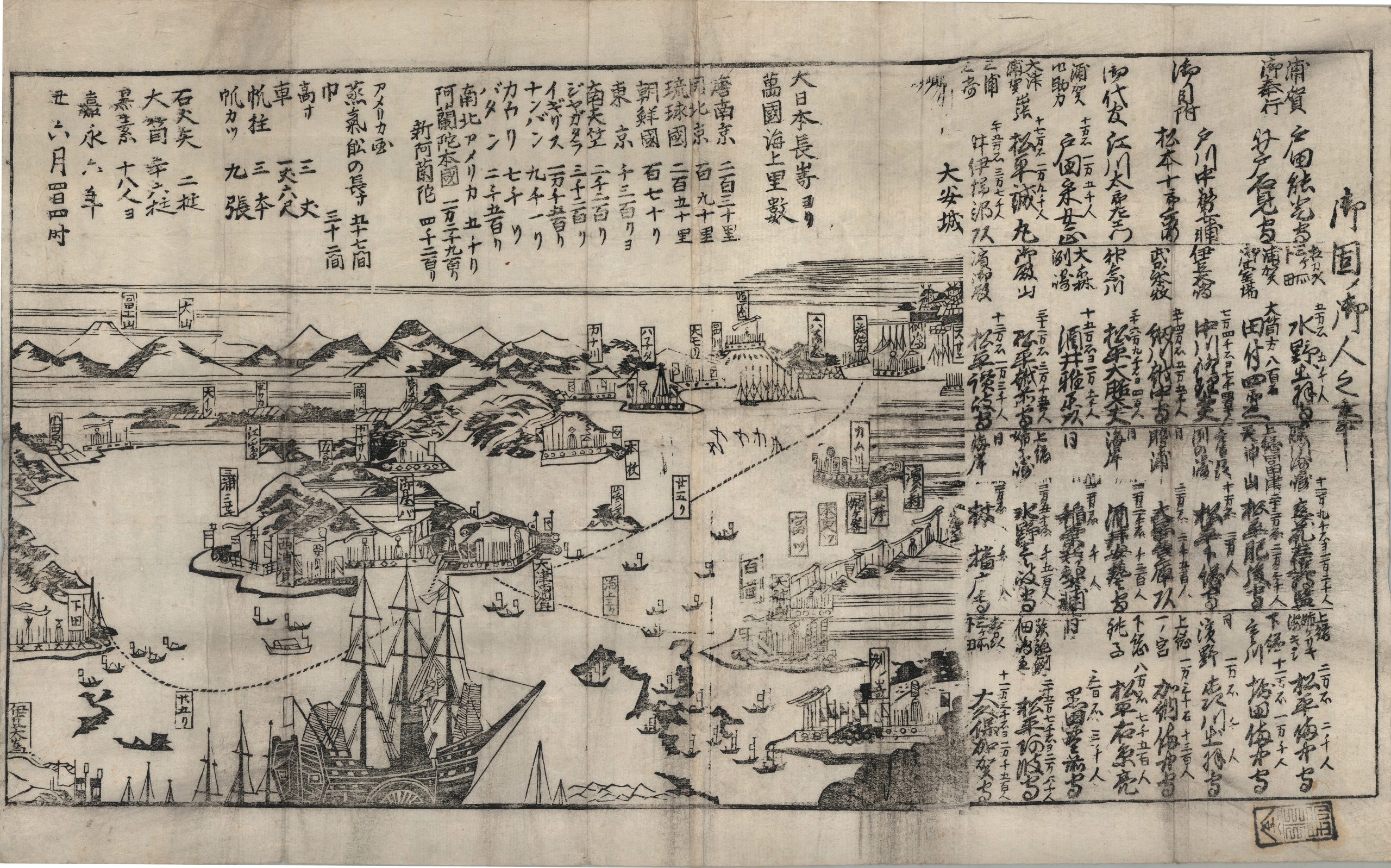
- Map Two: [US Commodore Matthew Perry’s Arrival in Japan July 8, 1853] by unknown cartographer.[23]
- Map Three: Japonia by Jodocus Hondius.[24]
Lessons Learned
The primary takeaway for SPCO has been that it is possible to create engaging sessions for seventy-five students in fifty minutes. Prior to our partnership with Dr. McCurdy, we had not tried anything close to this—either in number of attendees or style of assignment. After seeing the success of this activity, we have begun partnering with even larger classes (although we meet outside of our physical space for classes of ninety or more!).
This activity has also encouraged us to double down on active and experiential learning techniques. We are certainly not the first to realize the potential of this pedagogical approach in archives, but we are now striving to incorporate active engagement into every class session we conduct. We are not interested in simply showing materials anymore—we want students to engage in a meaningful way.
While still early in implementing this approach, our partnerships with faculty have become deeper and more meaningful. Rather than simply supplementing syllabi with primary sources, we are developing sessions that get students actively engaging in ways that traditional lectures do not.
Dr. McCurdy shared three key goals for her students in completing the SPCO World Tour:
- Reify history at the beginning of the semester for UTA’s diverse student population by inviting them into Special Collections to engage in tactile and visual learning experiences.
- Confront voids in geographic literacy head on to establish a foundation for future class discussions (and the students’ lives in general as global citizens).
- Introduce the concept of applying visual skills other than observation to art historical studies through sketching. Sketching is an experience in individual analysis and interpretation critical to the study of art history.
What’s Next?
The next step in our plan for the World Tour is to continue implementing it. In spring 2024, I plan to conduct an informal assessment by surveying the students ahead of their first visit and after their last visit of the semester. This assessment will help provide context for the students’ knowledge of not only geography and history, but also their knowledge of and comfort in Special Collections. I also hope to use this approach in other classes or workshops outside of class, and plan to use it as an example when reaching out to potential faculty partners.
Endnotes
[1] CIA, “World and Regional Maps – The World Factbook,” The World Factbook, accessed July 5, 2024, https://www.cia.gov/the-world-factbook/maps/world-regional/, archived July 5, 2024, at https://web.archive.org/web/20240705201830/https://www.cia.gov/the-world-factbook/maps/world-regional/.
[2] Students in this class are assigned readings from Dr. McCurdy’s Open Educational Resource textbook. Leah McCurdy, Where Does Art Come From?, (Arlington, TX: Mavs Open Press, 2022), https://uta.pressbooks.pub/wheredoesartcomefrom/, archived October 2, 2023, at https://web.archive.org/web/20231002170530/https://uta.pressbooks.pub/wheredoesartcomefrom/.
[3] Hendrik Hondius, cartographer, Turcici Imperii Imago, 1 cm equals 25 Milaria Germanica, 49 x 37 cm, (Amsterdam: Henricus Hondius, ca. 1639), UT Arlington Libraries, Special Collections, https://libraries.uta.edu/media/3910, archived January 10, 2024, at https://web.archive.org/web/20240110204358/https://libraries.uta.edu/media/3910.
[4] Pieter Keur and Jacob Keur, cartographers, Perigrinatie ofte Veertich-Jarige Reyse der Kinderen Israels, scale not given, 46 x 35 cm, (Dordrecht, Netherlands: Pieter and Jacob Keur, ca. 1729), UT Arlington Libraries, Special Collections, https://libraries.uta.edu/sites/default/files/inline-images/20112645A_med_0.jpg, archived May 5, 2023, at https://web.archive.org/web/20230505112347/https://libraries.uta.edu/sites/default/files/inline-images/20112645A_med_0.jpg.
[5] Alvin Jewett Johnson and Benjamin P. Ward, cartographers, Johnson’s Turkey in Asia, Persia, Arabia, &c., 1 inch equals 100 statute miles, in Johnson’s New Illustrated Family Atlas, With Descriptions Geographical, Statistical, and Historical by Alvin J. Johnson and Benjamin P. Ward (New York: Johnson & Ward, 1863), UT Arlington Libraries, Special Collections, https://libraries.uta.edu/media/3911, archived May 5, 2023, at https://web.archive.org/web/20230505112347/https://libraries.uta.edu/sites/default/files/inline-images/20112645A_med_0.jpg.
[6] Marshall Islands Stick Chart (Facsimile), scale not given, 36 x 59 cm, unknown publisher, no date, UT Arlington Libraries, Special Collections, https://library.uta.edu/digitalgallery/sites/library.uta.edu.digitalgallery/files/10020000-10029999/10023413.jpg, archived January 10, 2024, at https://web.archive.org/web/20240110210336/https://library.uta.edu/digitalgallery/sites/library.uta.edu.digitalgallery/files/10020000-10029999/10023413.jpg.
[7] Abrahamus Ortelius, cartographer, Descriptio Maris Pacifici, scale not given, 34 x 49 cm, (Antwerp: unknown publisher, 1589), UT Arlington Libraries Special Collections, https://libguides.uta.edu/ld.php?content_id=41176334, archived August 11, 2023, at https://web.archive.org/web/20230811164522/https://libguides.uta.edu/ld.php?content_id=41176334.
[8] John Arrowsmith, cartographer, Australia, 1 inch equals 50 English miles, in Atlas of Modern Geography: Constructed from the latest observations and discoveries for the use of schools by John Arrowsmith, (London: J. Arrowsmith, 1853), UT Arlington Libraries, Special Collections, https://library.uta.edu/digitalgallery/sites/library.uta.edu.digitalgallery/files/10020000-10029999/10023410.jpg, archived January 10, 2024, at https://web.archive.org/web/20240110210242/https://library.uta.edu/digitalgallery/sites/library.uta.edu.digitalgallery/files/10020000-10029999/10023410.jpg.
[9] Sebastian Münster, cartographer, Tavola, & discrizzione universal di tutta l’Africa, scale not given, 27 x 35 cm (Basel, Switzerland?: Heinrich Petri?, ca. 1558), UT Arlington Libraries, Special Collections, https://libguides.uta.edu/ld.php?content_id=47981396, archived December 3, 2022, at https://web.archive.org/web/20221203153600/https://libguides.uta.edu/ld.php?content_id=47981396.
[10] Robert Walton and Nicholas J. Visscher, cartographers, A New, Plaine & Exact Mapp of Africa, scale not given, (London: Robert Walton, 1658), UT Arlington Libraries, Special Collections, https://libraries.uta.edu/media/3912, archived January 10, 2024, at https://web.archive.org/web/20240110192006/https://libraries.uta.edu/media/3912.
[11] Martin Kunz, cartographer, Afrika, 1:25,000,000, (Ilzach, Germany?: Martin Kunz, ca. 1888), UT Arlington Libraries, Special Collections, https://library.uta.edu/digitalgallery/sites/library.uta.edu.digitalgallery/files/10020000-10029999/10023412.jpg, archived January 10, 2024, at https://web.archive.org/web/20240110210357/https://library.uta.edu/digitalgallery/sites/library.uta.edu.digitalgallery/files/10020000-10029999/10023412.jpg.
[12] John Arrowsmith, cartographer, Burmah, Siam, and Cochin China, 1 inch equals 50 English miles, 59 x 47 cm, (London: J. Arrowsmith, ca. 1838), UT Arlington Libraries, Special Collections, https://libraries.uta.edu/sites/default/files/inline-images/20112650_med_0.jpg, archived May 5, 2023, at https://web.archive.org/web/20230505112354/https://libraries.uta.edu/sites/default/files/inline-images/20112650_med_0.jpg.
[13] Moll, Herman, cartographer, A Map of the East Indies and the adjacent countries, scale not given, 61 x 99 cm, (London: Publisher not identified, 1715), UT Arlington Libraries, Special Collections, https://library.uta.edu/digitalgallery/sites/library.uta.edu.digitalgallery/files/10020000-10029999/10023407.jpg, archived January 10, 2024, at https://web.archive.org/web/20240110210054/https://library.uta.edu/digitalgallery/sites/library.uta.edu.digitalgallery/files/10020000-10029999/10023407.jpg.
[14] Martin Waldseemüller after Claudius Ptolemy, cartographers, Decima Asiae Tabula, scale not given, 61 x 41 cm, (Strasbourg, France: Johann Schott, ca. 1513), UT Arlington Libraries, Special Collections, https://libraries.uta.edu/sites/default/files/inline-images/01_20112652_med_1.jpg, archived May 5, 2023, at https://web.archive.org/web/20230505112513/https://libraries.uta.edu/sites/default/files/inline-images/01_20112652_med_1.jpg.
[15] Augustus S. Mitchell, cartographer, A New & Accurate Map of the Southern Province of Hindoostan, 1 inch equals 100 miles, in A New Universal Atlas Containing Maps of the Various Empires, Kingdoms, States, and Republics of the World, by Augustus S. Mitchell, (Philadelphia: Cowperthwait, DeSilver & Butler, 1850), UT Arlington Libraries, Special Collections, https://library.uta.edu/digitalgallery/sites/library.uta.edu.digitalgallery/files/10020000-10029999/10023409.jpg, archived January 10, 2024, at https://web.archive.org/web/20240110210235/https://library.uta.edu/digitalgallery/sites/library.uta.edu.digitalgallery/files/10020000-10029999/10023409.jpg.
[16] Vincenzo Coronelli, cartographer, America Settentrionale, 1 inch equals 90 Italian miles, 59 x 44 cm, (Venice: Vincenzo Coronelli, 1688), UT Arlington Libraries, Special Collections, https://libguides.uta.edu/ld.php?content_id=931800, archived August 11, 2023, at https://web.archive.org/web/20230811164709/https://libguides.uta.edu/ld.php?content_id=931800
[17] Herman Moll, cartographer, A Map of the West Indies or the islands of America in the North Sea with ye adjacent countries, scale not given, 57 x 100 cm, (London: publisher not identified, ca. 1715), UT Arlington Libraries, Special Collections, https://libguides.uta.edu/ld.php?content_id=41377978, archived August 11, 2023, at https://web.archive.org/web/20230811164426/https://libguides.uta.edu/ld.php?content_id=41377978.
[18] Jean Baptiste Bourguignon d’Anville, cartographer, A Map of South America, 1 inch equals 100 British miles, (London: Sawyer and Bennett, 1779), UT Arlington Libraries, Special Collections, https://texashistory.unt.edu/ark:/67531/metapth298841/m1/1/zoom/?q=anville%20south%20america&resolution=6&lat=2978.5&lon=5948, archived March 24, 2025, at https://web.archive.org/web/20250324182545/https://texashistory.unt.edu/ark:/67531/metapth298841/m1/1/zoom/?resolution=6&lat=2978.5&lon=5948, and https://texashistory.unt.edu/ark:/67531/metapth298842/m1/1/zoom/?q=anville%20south%20america&resolution=6&lat=3204.5&lon=6347.5.
[19] Sebastian Münster, cartographer, [Europe Depicted as a Queen], scale not given, 26 x 17 cm, in Das ander buch der cosmographen by Sebastian Münster, (Basel, Switzerland: Sebastian Münster, ca. 1540), UT Arlington Libraries, Special Collections, https://texashistory.unt.edu/ark:/67531/metapth190462/m1/1/zoom/?resolution=6&lat=4558&lon=3674.5, archived March 24, 2025 at https://web.archive.org/web/20250324183012/https://texashistory.unt.edu/ark:/67531/metapth190462/m1/1/zoom/?resolution=6&lat=4558&lon=3674.5.
[20] John Rocque, cartographer, Carte Generale des Postes de L’Europe, 1 inch equals 30 English miles, (Publication information not identified, 1758), UT Arlington Libraries, Special Collections, https://library.uta.edu/digitalgallery/sites/library.uta.edu.digitalgallery/files/10020000-10029999/10023411.jpg, archived January 10, 2024, at https://web.archive.org/web/20240110210209/https://library.uta.edu/digitalgallery/sites/library.uta.edu.digitalgallery/files/10020000-10029999/10023411.jpg.
[21] John Arrowsmith, cartographer, Russia & Poland, 1 inch equals 50 miles, in London Atlas of Universal Geography by John Arrowsmith, (London: J. Arrowsmith, 1840), UT Arlington Libraries, Special Collections, https://libraries.uta.edu/sites/default/files/inline-images/20112649_med_0.jpg, archived May 5, 2023, at https://web.archive.org/web/20230505112352/https://libraries.uta.edu/sites/default/files/inline-images/20112649_med_0.jpg.
[22] Abrahamus Ortelius, cartographer, Chinae, 1 cm equals 40 leagues, 35 x 48 cm, (Antwerp: Abrahamus Ortelius, 1589), UT Arlington Libraries, Special Collections, https://libraries.uta.edu/sites/default/files/inline-images/02_20112641A_med_0.jpg, archived May 5, 2023, at https://web.archive.org/web/20230505112515/https://libraries.uta.edu/sites/default/files/inline-images/02_20112641A_med_0.jpg.
[23] [U.S. Commodore Matthew Perry’s Arrival in Japan July 8, 1853], scale not given, (Publication information not identified, ca. 1853), UT Arlington Libraries, Special Collections, https://library.uta.edu/digitalgallery/sites/library.uta.edu.digitalgallery/files/10020000-10029999/10023408.jpg, archived January 10, 2024, at https://web.archive.org/web/20240110210050/https://library.uta.edu/digitalgallery/sites/library.uta.edu.digitalgallery/files/10020000-10029999/10023408.jpg.
[24] Jodocus Hondius, cartographer, Japonia, 1 inch equals 10 German miles, (Amsterdam: Hondius, 1606), UT Arlington Libraries, Special Collections, https://libraries.uta.edu/sites/default/files/inline-images/20112642A_med_0.jpg, archived May 5, 2023, at https://web.archive.org/web/20230505112517/https://libraries.uta.edu/sites/default/files/inline-images/20112642A_med_0.jpg.
Media Attributions
About the author
name: Evan Spencer
institution: University of Texas at Arlington Libraries Special Collections
Evan Spencer is the Outreach & Instruction Archivist at UT Arlington Libraries Special Collections. He is a dedicated and passionate Public Historian and Archivist who strives to put the public and their understanding of archival records at the forefront of everything he does. His purpose is to serve people by helping wide audiences engage with history.

![[US Commodore Matthew Perry’s Arrival in Japan July 8, 1853]](https://library.uta.edu/digitalgallery/sites/library.uta.edu.digitalgallery/files/10020000-10029999/10023408.jpg)